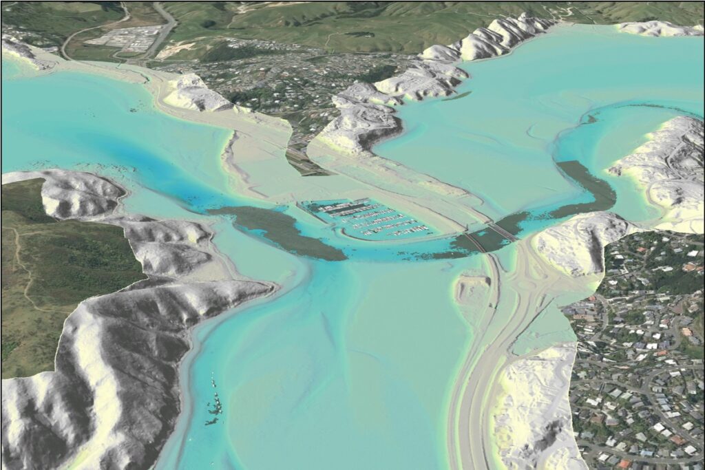































































A detailed 3D view of Te Awarua-o-Porirua Harbour is illustrating a national effort to improve coastal planning, with iwi, community groups and other organisations invited to help put the mapping data to practical use.
Toitū Te Whenua Land Information New Zealand has released the harbour visualisation alongside a call for organisations to join its 3D Coastal Mapping Advisory Group.
The group will help test how information about the coast and seafloor can support work such as assessing erosion, modelling tsunami and storm surges, and protecting culturally significant places.
The next intake opens in March 2027, when more mapping data will become available. Organisations can register their interest now.
For Porirua, the image offers a different perspective on familiar surroundings, showing the harbour's underwater terrain alongside the land around it. It is a data visualisation, rather than a conventional aerial photograph.
The wider programme aims to establish a detailed baseline of coastal land and seabed heights. Future surveys can then be compared with that baseline to measure change, including changes caused by storms, earthquakes and other natural hazards.
Programme lead Stuart Caie says the advisory group connects the data with people who can apply it to real-world challenges.
“Communities face big decisions about where to build, what to protect and how to respond to the impacts of a natural hazard. Each use case helps show what this data can deliver and gives decision makers better information to work from,” he says.
Possible applications also include search and rescue operations, understanding coastal processes and detecting changes to the coastline. LINZ expects the work to help with climate adaptation and decisions about infrastructure, conservation areas and coastal heritage.
Members will work with the programme team to test a particular application and record what benefits it provides. Participation is intended to be flexible: organisations join when data relevant to their work becomes available and generally remain involved until their project is complete.
The invitation extends to local and central government, iwi, researchers, universities, industry and community groups.
The mapping programme began in late 2023 and runs until June 2028. It will cover up to 40 percent of New Zealand's coastline, prioritising populated areas, significant infrastructure and places at greater risk of coastal flooding.
LINZ describes it as a first step towards a consistent national baseline, rather than a complete picture of the entire coastline. Further surveying and repeat measurements will be needed to extend coverage and track change over time.
Organisations interested in taking part can email [email protected]. The programme's online progress tracker shows published and upcoming areas, while details of tested uses will be added to the LINZ website as the work develops.